
Trees in the USA (click maps to enlarge)
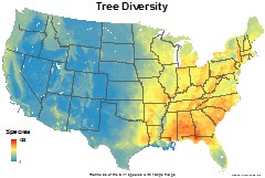
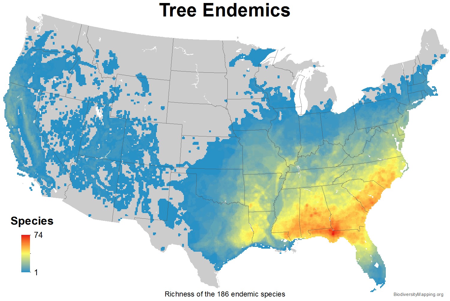
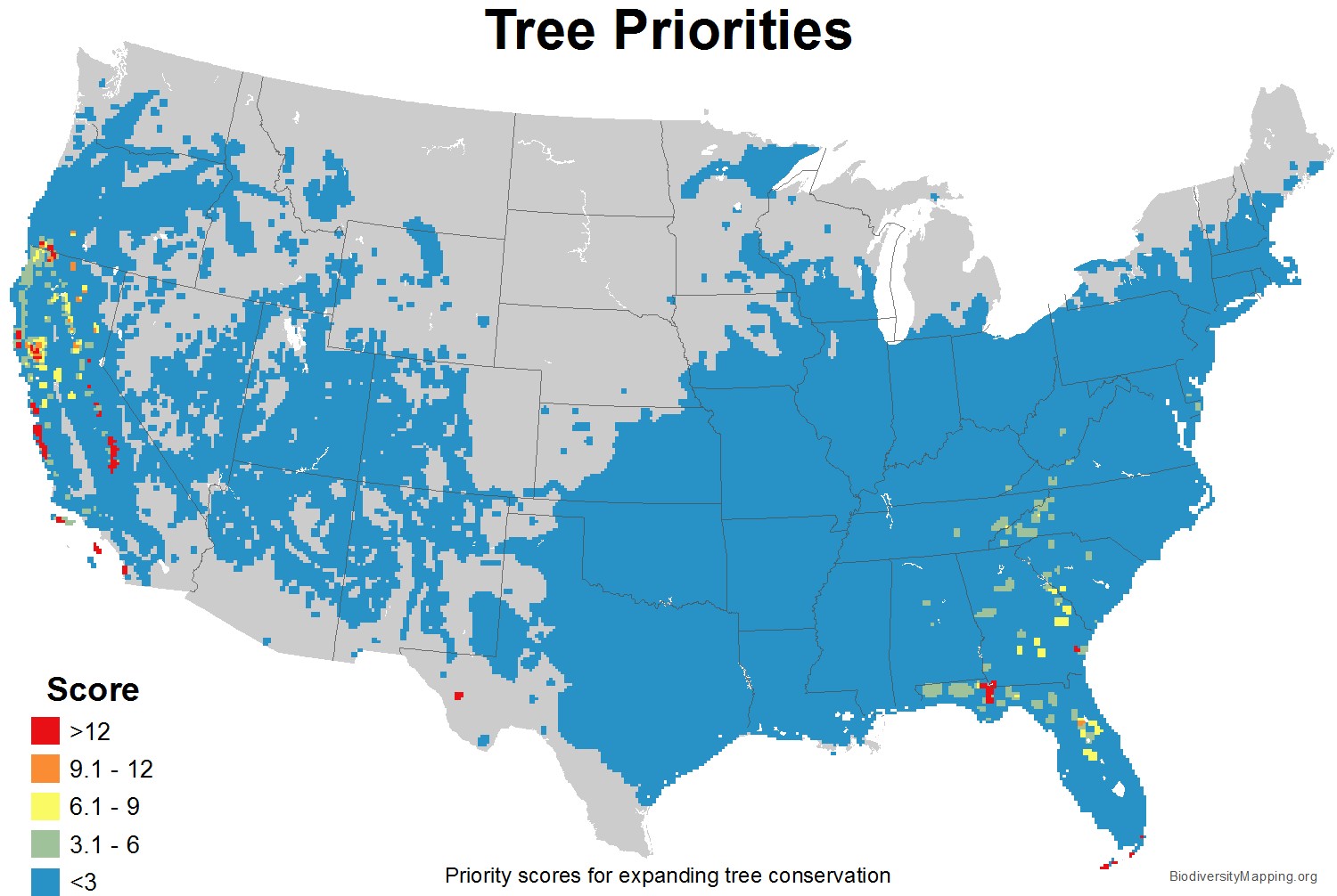
Maps of tree diversity in the USA include the total species richness and endemic species. Maps are based on data from, U.S. Geological Survey (1999) Digital representation of “Atlas of United States Trees” by Elbert L. Little, Jr.
These maps, as well as the conservation priorities map, first appeared in the scientific publication, “U.S. protected lands mismatch biodiversity priorities,” by Clinton N. Jenkins, Kyle S. Van Houtan, Stuart L. Pimm, and Joseph O. Sexton. Published April 6, 2015, in Proceedings of the National Academy of Sciences. www.pnas.org/cgi/doi/10.1073/pnas.1418034112
Maps have been generated at a spatial resolution of 10×10 km for rasters, or maintained as vector format where more appropriate, and use an Albers Equal Area Conic projection. Maps represent native, extant species only. Tables of the species included are available for download here.
A zip file with higher resolution jpegs of the above maps can be downloaded here.